India’s Frontier Architecture: Land Borders, Maritime Bastions & 21st-Century Security Challenges
An exhaustive strategic analysis of Bharat's 15,106.7 km terrestrial frontiers, 7,516.6 km coastline, seven neighboring nations, and the five critical challenges defining border security from Siachen to the Indian Ocean.
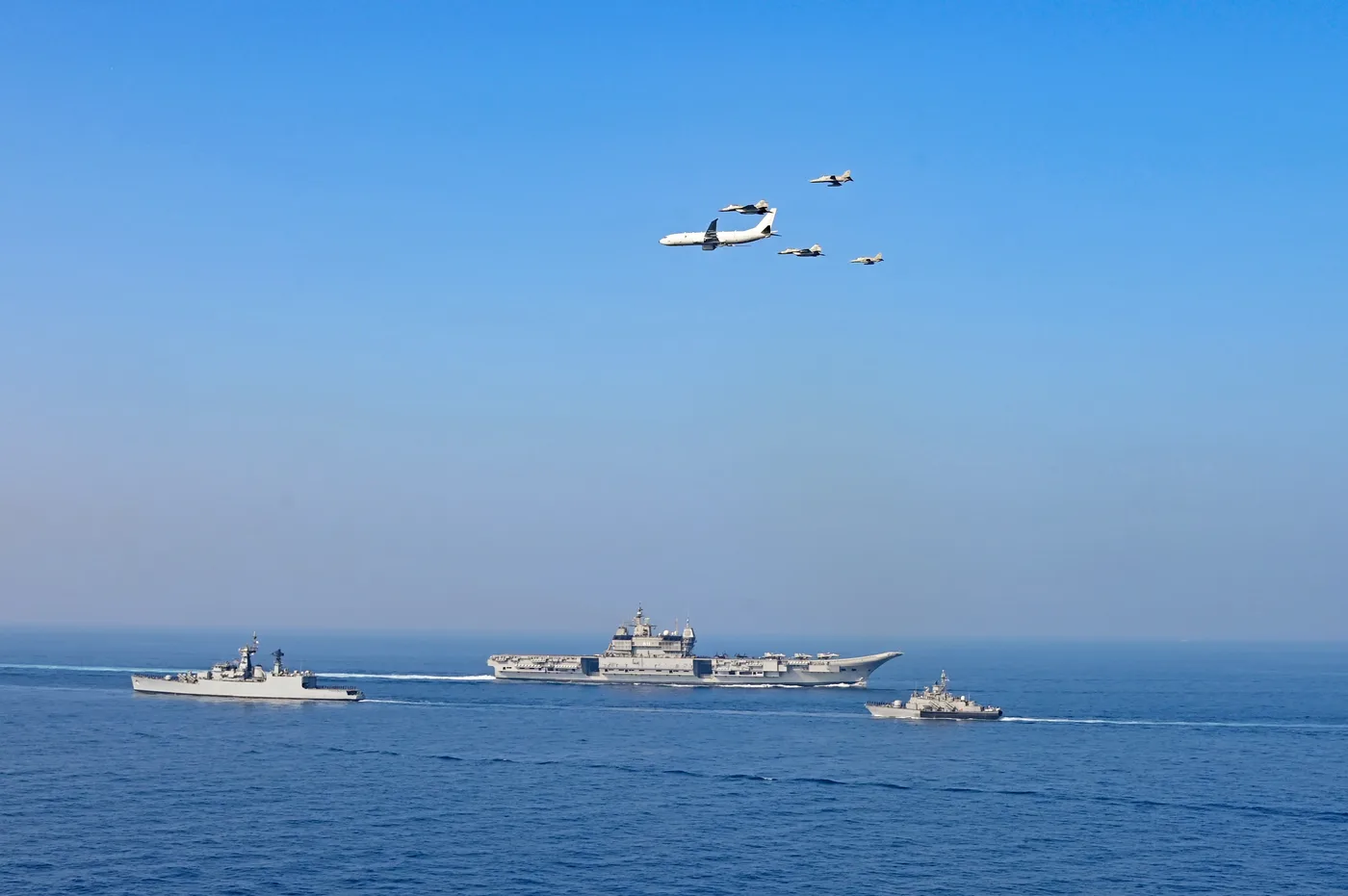
PLATE I (PIB PRID 2071695) — Indigenous Aircraft Carrier INS Vikrant (R11) operating in full Carrier Battle Group (CBG) formation alongside frontline fleet escorts, P-8I long-range maritime reconnaissance aircraft, and embarked MiG-29K naval strike fighters during Presidential operational review off Goa.
1. Introduction: The Strategic Perimeter of Bharat
India represents one of the most geographically diverse and strategically contested territorial configurations on Earth. Safeguarding sovereign integrity requires synchronised vigilance across:
- 15,106.7 Kilometres of Land Borders: Stretching across 18 States and Union Territories, from the Karakoram Pass in the north to the tropical mangrove deltas of the Sundarbans.
- 7,516.6 Kilometres of Coastline: Comprising 5,422.6 km of mainland coastline and 2,094 km of island territories, overseeing vital sea lanes of communication (SLOCs).
- 2.37 Million Square Kilometres of Exclusive Economic Zone (EEZ): An ocean domain rich in living and non-living hydrocarbons, polymetallic nodules, and maritime transit lanes.
Understanding India’s border security posture demands moving beyond post-colonial administrative demarcations to appreciate the living civilizational frontiers of Bharat—where physical terrain, human demography, and geopolitical friction intersect.
2. The Seven Terrestrial Bordering Nations
India shares terrestrial borders with seven sovereign nations, each presenting unique legal regimes, operational challenges, and bilateral dynamics:
2.1 Bangladesh (4,096.7 km)
- Border Type: International Border (IB).
- Bordering States: West Bengal (2,216.7 km), Tripura (856 km), Meghalaya (443 km), Mizoram (318 km), and Assam (263 km).
- Primary Guarding Force: Border Security Force (BSF).
- Strategic Dynamics: The longest land boundary India shares with any nation. Marked by complex riverine terrain, chars (shifting sand islands), and dense population settlements right up to the zero line. The deployment of the Comprehensive Integrated Border Management System (CIBMS) and smart technological fencing is critical to stemming illegal demographic infiltration, cattle smuggling, and trans-border criminal syndicates.
2.2 China (3,488.0 km)
- Border Type: Line of Actual Control (LAC).
- Bordering States/UTs: Ladakh (UT), Himachal Pradesh, Uttarakhand, Sikkim, and Arunachal Pradesh.
- Primary Guarding Forces: Indo-Tibetan Border Police (ITBP) and Indian Army.
- Operational Sectors:
- Western Sector (Ladakh): Glaciated, hyper-arid plateaus requiring year-round high-altitude acclimatisation and extreme cold weather clothing (ECWCS).
- Middle Sector (HP & Uttarakhand): High mountain passes with traditional pilgrimage and trade routes.
- Eastern Sector (Sikkim & Arunachal Pradesh): Dense montane ridgelines and tri-junction pivots (e.g. Doklam, Yangtse).
- Strategic Posture: Addressed through re-balanced dual-tasked Strike Corps, Border Roads Organisation (BRO) all-weather strategic tunnels (Sela, Nechiphu, Zojila, Shinku La), and forward airfields (ALGs) like Nyoma and Daulat Beg Oldie.
2.3 Pakistan (3,323.0 km)
- Border Type: Line of Control (LoC — 740 km), Actual Ground Position Line (AGPL — 110 km), and International Border (IB).
- Bordering States/UTs: Jammu & Kashmir (UT), Ladakh (UT), Punjab, Rajasthan, and Gujarat.
- Primary Guarding Forces: Indian Army along the LoC and Siachen Glacier; Border Security Force (BSF) along the International Border.
- Strategic Posture: The most active and combat-tested frontier. Fortified by the multi-tier Anti-Infiltration Obstacle System (AIOS), electrified concertina wire, ground sensors, thermal imagers, and round-the-clock counter-tunneling monitoring.
2.4 Nepal (1,751.0 km)
- Border Type: Open International Border governed by the 1950 Indo-Nepal Treaty of Peace and Friendship.
- Bordering States: Uttarakhand, Uttar Pradesh, Bihar, West Bengal, and Sikkim.
- Primary Guarding Force: Sashastra Seema Bal (SSB).
- Strategic Posture: Facilitates free transit for citizens of both nations while preserving deep civilizational and cultural bonds. Security focus centres on preventing third-country hostile intelligence penetration, human trafficking, and illicit counterfeit trade.
2.5 Myanmar (1,643.0 km)
- Border Type: International Border.
- Bordering States: Arunachal Pradesh, Nagaland, Manipur, and Mizoram.
- Primary Guarding Forces: Assam Rifles and Indian Army.
- Strategic Dynamics: Rugged, jungle-clad hills traditionally governed by the Free Movement Regime (FMR). Following civil unrest in Myanmar, cross-border insurgent sanctuaries, and illicit drug flows from the Golden Triangle, the Government of India has suspended the FMR and initiated full-scale smart fencing along the border.
2.6 Bhutan (699.0 km)
- Border Type: Peaceful Himalayan International Boundary.
- Bordering States: Sikkim, West Bengal, Assam, and Arunachal Pradesh.
- Primary Guarding Force: Sashastra Seema Bal (SSB).
- Strategic Context: A model of peaceful, cooperative border governance anchored in mutual trust. Close coordination ensures the security of the vital Doklam tri-junction, protecting the vulnerable Siliguri Corridor (“Chicken’s Neck”).
2.7 Afghanistan (106.0 km)
- Border Type: Sovereign International Border along the Wakhan Corridor.
- Bordering State/UT: Ladakh (PoK region).
- Strategic Significance: Represents India’s sovereign de jure geographic connection to Central Asia and the historic Silk Route, reaffirmed by the unanimous 1994 Parliamentary Resolution on Jammu & Kashmir.
3. The 18 International Border States & Union Territories
India’s frontier management is distributed across 18 distinct sub-national administrative units:
| Sector | States & Union Territories | Primary Frontiers Guarded |
|---|---|---|
| Northern & Trans-Himalayan | Ladakh (UT), Jammu & Kashmir (UT), Himachal Pradesh, Uttarakhand | China (LAC), Pakistan (LoC/IB), Afghanistan (Wakhan) |
| Western Desert & Riverine | Punjab, Rajasthan, Gujarat | Pakistan (IB, Rann of Kutch, Sir Creek) |
| Central Himalayan & Gangetic | Uttar Pradesh, Bihar, West Bengal | Nepal, Bangladesh, Bhutan |
| Northeastern Frontier | Sikkim, Assam, Meghalaya, Tripura, Mizoram, Manipur, Nagaland, Arunachal Pradesh | China (LAC), Bangladesh, Myanmar, Bhutan |
4. Maritime Frontiers & Island Bastions
India’s maritime security envelope extends far beyond its coastlines:
- Andaman & Nicobar Command (ANC):
India’s premier joint tri-service command at Port Blair anchors our eastern maritime flank. Overlooking the Six Degree Channel and the northern entrance of the Strait of Malacca, ANC provides crucial surveillance over commercial transit routes and foreign submarine movements. - Lakshadweep Bastion (INS Jatayu):
Commissioned on Minicoy Island, INS Jatayu significantly augments operational reach over the Nine Degree Channel, securing vital tanker routes connecting the Persian Gulf and Red Sea to East Asia. - Coastal Surveillance Network (CSN):
Integrates 46 static radar stations, 38 mobile surveillance units, Vessel Traffic Management Systems (VTMS), and Indian Coast Guard patrol vessels to provide an unblinking radar picture across 2.37 million sq km of sovereign waters.
5. Five Defining Strategic Challenges of India’s Frontiers
5.1 Cross-Border Infiltration & Proxy Terrorism (घुसपैठिए एवं आतंकवाद)
State-sponsored proxy networks continue to probe physical gaps in border fencing, exploiting thick foliage, nullahs, and underground tunnels along the LoC and International Border. Mitigating this threat requires the continuous upgrade of the Anti-Infiltration Obstacle System (AIOS) with uncooled thermal imagers, seismic sensors, and automated surveillance towers.
5.2 Demographic Alterations & Illegal Migration (पलायन एवं जनसांख्यिकी)
Porous stretches along the eastern border have witnessed prolonged, unmonitored human migration over decades. This has triggered significant demographic alterations in border districts of West Bengal, Assam, and northern Bihar. Preserving internal stability demands strict technological sealing, biometric identity registration, and border community vigilance.
5.3 Rogue Drones & Narco-Terror Logistics (ड्रोन घुसपैठ)
The proliferation of cheap, high-payload commercial and militarised quadcopters has opened a vertical domain of border compromise along the western frontier. Drones are routinely intercepted dropping synthetic narcotics, automatic pistols, and RDX ammunition into Punjab, Jammu, and Rajasthan. Indigenous counter-UAS platforms combining RF detection, radar tracking, and soft-kill/hard-kill neutralisation (developed by DRDO and private defence enterprises) are being deployed in depth.
5.4 Border Infrastructure & The Vibrant Villages Programme (बुनियादी ढांचा)
Historically, inadequate infrastructure in remote border villages led to migration towards urban centres, leaving forward sectors unpopulated. Under the Vibrant Villages Programme (VVP), the Government of India has recognised border residents as the nation’s First Line of Defence. By providing 4G connectivity, solar micro-grids, year-round road access, and eco-tourism opportunities, forward communities are empowered to act as strategic eyes and ears for security forces.
5.5 Civilizational Geography & Strategic Frontier Consciousness (अखंड भारत की सीमाएं)
India’s borders are not merely administrative lines drawn by colonial cartographers; they represent the historic cultural perimeter of Bharatvarsha—bounded by the snow-capped Himalayas in the north and the Indian Ocean in the south (“उत्तरं यत्समुद्रस्य हिमाद्रेश्चैव दक्षिणम्। वर्षं तद् भारतं नाम भारती यत्र संततिः॥” — Vishnu Purana). Defending these borders requires not only weapons and radar, but deep national civilizational consciousness and strategic clarity.
6. Conclusion: The Sovereign Path Ahead
Safeguarding Bharat’s frontiers in an era of multi-domain warfare demands complete civil-military fusion:
- Integrated Theatre Commands: Merging northern and maritime commands to present a unified operational posture.
- Smart Border Fencing: Completing the CIBMS across riverine and jungle sectors.
- Domestic Defence Manufacturing: Deploying indigenous drones, night-vision optics, and communication systems under Atmanirbhar Bharat.
- Border Community Empowerment: Anchoring our sovereignty in the patriotic resilience of frontier citizens.
Defence Observer remains dedicated to non-sensitive, authoritative research documenting India’s borders from tactical outposts to national policy boards—advancing national security from Border to Boardroom™.
Ministry of Defence (PIB) Disclosures & Doctrinal Synthesis
Official Government of India Press Information Bureau (PIB) records corroborated and synthesized for this research monograph under our 5-Level Verification Protocol.
Indigenous Carrier Battle Group Maturity: INS Vikrant (R11) and Multi-Axis Sea Control in the Western Indian Ocean
The Supreme Commander of the Armed Forces embarked Indigenous Aircraft Carrier INS Vikrant off Goa, observing 15 frontline surface combatants and submarines, deck-launched MiG-29K fighter operations, missile firing drills, and coordinated P-8I maritime patrol flypasts.
Transitioning INS Vikrant from sea trials to an integrated 15-ship Carrier Battle Group validates the Indian Navy’s two-carrier operational doctrine, enabling simultaneous sea-control task groups across the Arabian Sea and Bay of Bengal. Coupling deck-launched fighter sorties with P-8I anti-submarine warfare telemetry closes surveillance gaps across the Nine-Degree Channel, Bab-el-Mandeb approaches, and Western IOR sea lines of communication.
High-Altitude Multi-Domain Integration: Exercise Poorvi Prahar and Sensor-to-Shooter Fusion Along the Eastern LAC
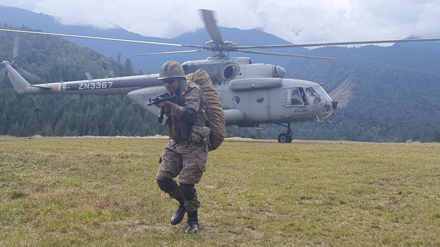
The Indian Armed Forces conducted high-altitude tri-service Exercise Poorvi Prahar in the forward areas of the Eastern Theatre from November 10 to 18, integrating IAF fighters, Chinook and Prachand helicopters, Indian Navy P-8I overland reconnaissance aircraft, and swarm drones with M777 ultra-light howitzers under a common operational picture.
Deploying Indian Navy P-8I maritime reconnaissance aircraft over the Himalayan crestline alongside IAF fighters and Army artillery proves that cross-domain sensor fusion is already operational ahead of formal theatre command notification. Shifts India’s continental posture from static linear border holding to rapid vertical envelopment and precision time-sensitive targeting across high-altitude valleys.
Littoral & Critical Infrastructure Defence: Auditing the 21-Agency Pan-India Coastal Security Grid in ‘Sea Vigil-24’
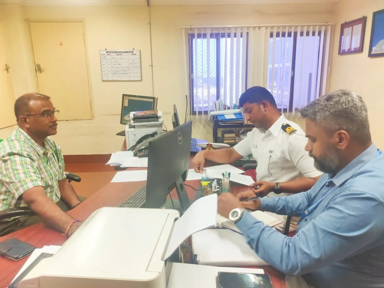
The Indian Navy coordinated the fourth edition of pan-India coastal defence Exercise Sea Vigil-24 across all coastal states and Union Territories, Lakshadweep, and the Andaman & Nicobar Islands, mobilizing 6 ministries and 21 security/maritime agencies to audit coastal radar chains, ports, oil rigs, and subsea cable landing stations.
Sea Vigil-24 bridges the seam between homeland littoral security and high-end naval warfighting (TROPEX), stress-testing the National Command Control Communication and Intelligence (NC3I) network against asymmetric sea-borne infiltration and hybrid sabotage. Hardens offshore energy platforms, nuclear installations, strategic naval bases, and submarine optical-fibre landing stations against grey-zone maritime disruption.